

1917 and 1922 Saskatchewan One Room School Inspectorate Maps | |

|
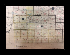
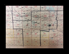
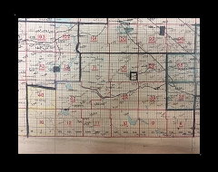
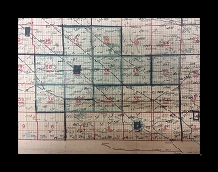
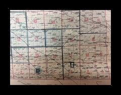
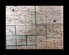
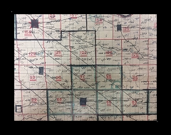
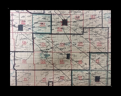
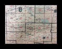
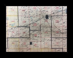
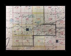
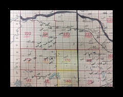
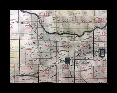
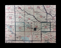
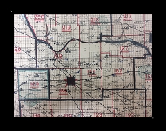
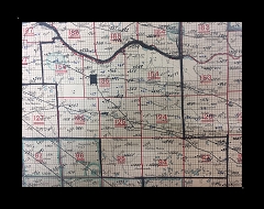
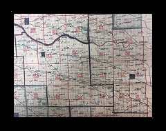
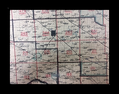
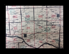
1917 School Inspectorate MapThis map shows the province's Rural Municipalities as of 1917 - thin black lines.There are several map segments online so it can be read. The image of the entire provincial map just could not be read at all. From the Legend; Upon the map are drawn the School Inspectorate boundaries - thick black lines. (This is the area the one school inspectors had to cover before the highways were asphalted and graded, sometimes travelling by horseback, or Model A car over the prairie) High Schools are green dots, the University of Saskatchewan is yellow Red are consolidated schools Additionally, the school district numbers are marked (Numerical listing is online to determine school name here) as well as a dot is given for the location of the school house location, however the school district boundaries are not shown on this map. This map is divided into one mile by one mile sections, and is marked by township and range numbers. (Legal land descriptions explained) The map web album will be provided (time permitting) with the index by Rural Municipality. Volunteer run project. However, in the meatime, scroll through these above Map images which are uploaded. ;-) School Inspectorate Map. Provincial Archives of Saskatchewan. Map collection B 8/2. Commissioner of Education Boundaries. 1917. School Inspectorate Map. Provincial Archives of Saskatchewan. Map collection B 8/2. Commissioner of Education Boundaries. 1917.. Other school maps Online Historical Map Digitization Project School district names ordered by school district number Township, Range and Meridian - Legal Land Descriptions explained Thank you for stopping by # Web Page title: URL: Copyright ? Web Publish Date: All East (Right)s Reserved E-mail Webmaster ... Important Notice |