 | Clayton McLain Memorial Museum, Cut Knife |
Clayton McLain Memorial Museum, Cut Knife has information on
| ||||||||||||||||||||||||||||||||||||||||||||||||||||||||||||||||||||||||||||||||||||||||||||||||||||||||||||||||||||||||||||||||||||||||||||||||||||||||||||||||||||||||||||||||||||||||||||||||||||||||||||||||||||||||||||||||||||||||||||||||||||||||||||||||||||||||||||||
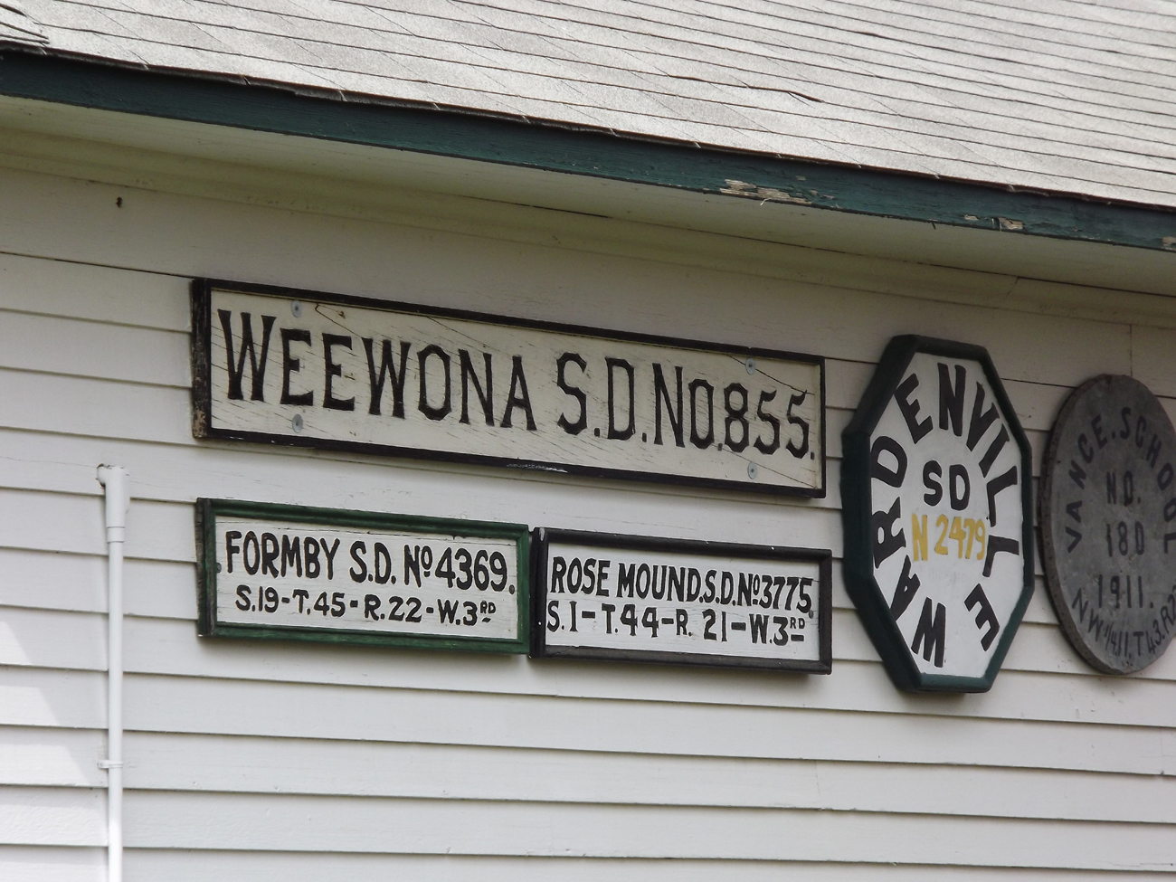
Please email the SK ORSH webmaster if you have information any of the missing legal land description of the above School Houses. Several sources were consulted to add the legal land descriptions. The GPS coordinates added courtesy of the Clayton McLain Memorial Museum. In 2012 as part of the Cut Knife Centennial project all one room schoolhouse sites, cemeteries and points of interest were visited and photographed and their GPS locations recorded. At the museum, they have a couple of original one room schoolhouses moved onto their grounds as noted above, the interiors have been furnished with historical artifacts from the one room schoolhouse era. School banners, pupil listings, teacher listings, and histories of a few of the schoolhouses are also visible inside the museum. Thank you.
|
|
One Room School Districts, Churches, Cemeteries in the area of Yorkton, and the New Finland District |
|
Other web links for the Clayton McLain Memorial Museum Clayton McLain Memorial Museum SAIN Clayton McLain Memorial Museum Facebook Page Clayton McLain Memorial Museum Cut Knife Museum Blogspot Cut Knife Museum Web Pages Cut Knife Saskbiz |
|
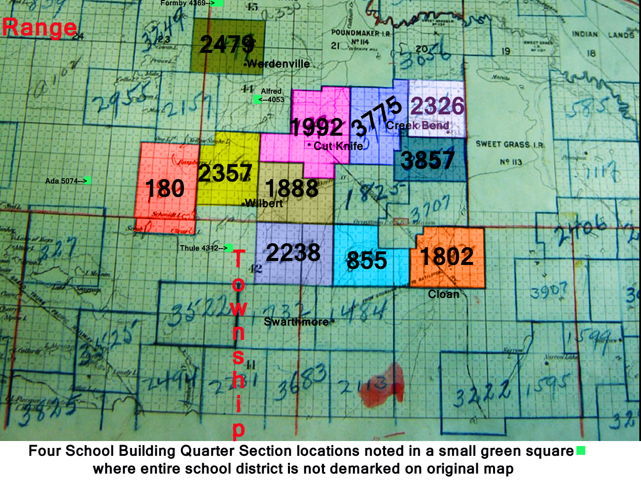
Above schools marked on this school map. School Maps segment used with permission
|
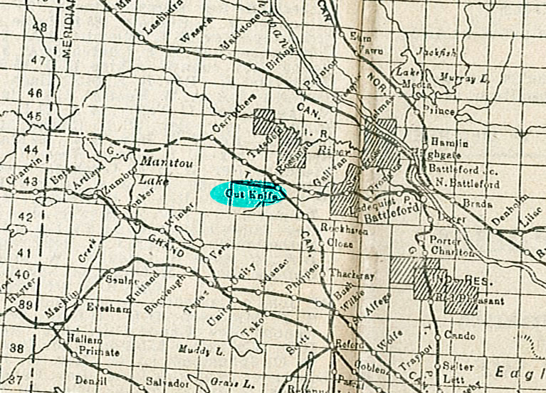
Railway map segment from 1925 Waghorn's Guide and Map used with permission
Township Range, meridian information
Thank you for stopping by #
Web Page title:
URL:
Copyright ? Web Publish Date: All Rights Reserved
Saskatchewan One Room School House Project
Battleford Gen Web Region
One Room School Districts, Churches, Cemeteries
in the area of Yorkton, and the New Finland District
E-mail Webmaster ... Important Notice - Submitter
Bibliography:
1.
From: Red Lauttamus
To:Julia Adamson ORSH webmaster
Subject: Cut Knife Museum Saskatchewan
Date August 17, 2012
![]()