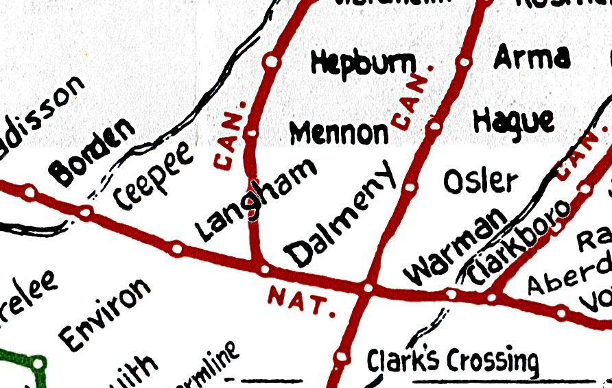
Canadian National Railways Western Lines Map
The area covered is from Port Arthur/Fort William and Churchill to Prince Rupert and Vancouver Island- town names and locations as after 1954
showing Canadian National Railways lines in Western Canada from August 1954, Western Canada British Columbia, Alberta, Saskatchewan, Manitoba and a portion of Ontario.
Not only were the the Canadian National lines shown, but also Canadian Pacific, Greater Winnipeg Water District, Northern Alberta, Pacific Great Eastern, Midland Railway of Manitoba
(joint Great Northern and Northern Pacific) and Great Northern (in BC).
All these lines have probably 95%+ of the points on each line shown
Read Me File
Problems Joint Track Agreements and Benefitsworking with the Canadian National Railways Western Lines Map
CNR Map 1954 |
|
Canadian National Railways Western Lines Map
Benefits of using map
The area covered is from Port Arthur/Fort William and Churchill to Prince Rupert and Vancouver Island- town names and locations as after 1954
showing Canadian National Railways lines in Western Canada from August 1954, Western Canada British Columbia, Alberta, Saskatchewan, Manitoba and a portion of Ontario.
Not only were the the Canadian National lines shown, but also Canadian Pacific, Greater Winnipeg Water District, Northern Alberta, Pacific Great Eastern, Midland Railway of Manitoba
(joint Great Northern and Northern Pacific) and Great Northern (in BC).
All these lines have probably 95%+ of the points on each line shown
 |
- 760 placenames for the province of British Columbia
- 886 placenames for the province of Alberta
- 1,321 placenames for the province of Saskatchewan
- 818 placenames for the province of Manitoba
- 169 placenames for the province of Ontario (partial showing on map)
- 7 placenames for the state of Minnesota (partially snowing on map)
On contemporary maps, placenames are not situated as close together as they were historically.
This map does indeed, help to identify and locate historical placenames which are now unofficial, unincorporated, or have disappeared from modern maps.
Please E-mail with comments, feedback or regarding any items which need corrections or additions.
 |

Copyright: Email: saskgenweb@yahoo.com Webmaster Julia Adamson Sign Guestbook View Guestbook URL: saskgenweb.ca/canmaps/RailwayMap/index.html We encourage links to this page. This web site was made with possible with the original scan and original map creation from Larry Walton. It is the intention of this site to make Western Canada British Columbia, Alberta, Saskatchewan, Manitoba - The area covered is from Port Arthur/Fort William and Churchill to Prince Rupert and Vancouver Island- town names and locations as after 1954 available to persons with a historical or genealogical interest in this area. There are no service charges or fees for use of this map service, and use of this site constitutes your acceptance of these Conditions of Use. This page is dedicated to the free sharing of this Western Canada historical data for personal use. Any further use of these maps would require permission from the contributor Larry Walton as per copyright laws in Canada. Dedication Webmaster: NEW EMAIL saskgenweb@yahoo.com |

 Flying U to Williams Lake should be going roughly